Land records in India are fundamental for establishing ownership, ensuring secure transactions, and facilitating various government and private activities related to land. Historically, these records were maintained manually, leading to inefficiencies, errors, and disputes. However, significant strides have been made in recent years towards digitizing and modernizing land records across all States and Union Territories (UTs) under initiatives like the Digital India Land Records Modernization Programme (DILRMP)
Understanding Land Records in India
Land records are documents that contain detailed information about land parcels, including their ownership, dimensions, boundaries, usage, and any associated liabilities or transactions. They serve as critical evidence in land disputes, property transactions, and for accessing government schemes or financial services.
Key components of land records generally include:
- Textual Records: These provide information about ownership, type of land, revenue payable, and encumbrances. The most crucial among these is the Record of Rights (RoR).
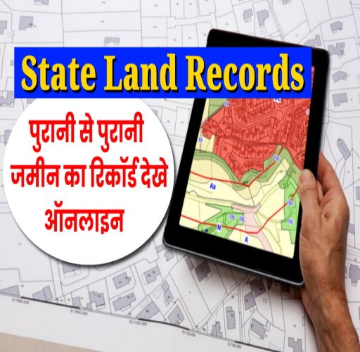
- Spatial Records (Cadastral Maps): These are maps that visually represent land parcels, their boundaries, and dimensions. They are essential for identifying the physical location and layout of a property.
- Survey Records: These document the process of land measurement and demarcation.
- Mutation Records: These record changes in ownership due to sale, inheritance, gift, or other transfers.
- Record of Land Use: Details about how the land is being utilized (e.g., agricultural, residential, commercial).
- Records of Encumbrances: Information about any loans, mortgages, or legal claims on the property.
The Significance of Record of Rights (RoR)
Record of Rights (RoR) is the most pivotal document in land records. It is also known by various regional names like Jamabandi (in Haryana, Punjab, Himachal Pradesh, Jammu & Kashmir), Patta/Chitta (in Tamil Nadu), Porcha/Khatian (in West Bengal), 7/12 Utara (in Maharashtra and Gujarat), Meebhoomi (Andhra Pradesh), and Bhuiyan (Chhattisgarh, Madhya Pradesh).
What is an RoR?
An RoR is a legal document maintained by the State Revenue Department that provides a comprehensive overview of a land parcel’s details. It serves as:
- Proof of Ownership: It legally establishes who owns a particular piece of land. Without an RoR, proving ownership can be complex.
- Transparency in Transactions: For buyers and sellers, an RoR ensures transparency by allowing buyers to verify the seller’s rightful ownership and check for any existing liabilities (like loans or mortgages).
- Dispute Resolution: In the event of land disputes, the RoR serves as critical evidence, helping courts and authorities settle conflicts by providing accurate and official details about ownership and usage.
- Tax Calculation: Local governments use the RoR to accurately calculate land revenue or property taxes.
- Access to Government Schemes and Loans: Farmers often require their RoR to avail government subsidies, crop loans, and other benefits, as banks typically demand it when land is offered as collateral.
What Information Does an RoR Typically Include?
While the format of the RoR varies from state to state, it generally contains the following crucial information:
Ownership Details:
- Name(s) of the current owner(s) or co-owners.
- Father’s/Husband’s name of the owner.
- Details of the history of ownership transfers (mutations).
Land Description:
- Location (Village, Tehsil/Taluka, District).
- Survey Number (also known as Khasra number in some states) and Plot Number (Dag Number).
- Total area of the land parcel (often in hectares/acres or local units).
- Land classification (e.g., agricultural, residential, commercial, barren, forest land).
- Type of soil.
Cultivation Information (for agricultural land):
- Details of crops grown (if applicable).
- Area under cultivation.
- Type of irrigation available.
- Details of tenants cultivating the land (if any).
Usage Rights and Liabilities:
- Rights to use the land for specific purposes (e.g., farming, construction).
- Any outstanding loans, mortgages, or legal claims on the land (encumbrances).
- Details of easements or rights of way.
Tax Details:
- Records of land revenue or property tax payable by the owner.
- Status of tax payments.
- Mutation Details: Records of changes in ownership, particularly after a sale, inheritance, or gift.
State and UT Land Records Portals: Accessing Your RoR Online
How to Use These Portals
While each portal may have a slightly different interface, the general steps to access land records usually involve:
- Visiting the respective official portal.
- Looking for options like “View RoR,” “Know Your Land,” “Jamabandi Nakal,” “Bhulekh,” or similar links.
- Selecting your District, Tehsil/Taluka, and Village.
- Entering the Survey Number, Khasra Number, Khatauni Number, or sometimes the owner’s name.
- Viewing or downloading the requested land record.
State & UT Land Records Portals – FAQs
Here are some frequently asked questions about accessing land records and the Record of Rights (RoR) through state and Union Territory portals:
Q1: What are land records?
A1: Land records are official documents that contain details about land parcels, including ownership, dimensions, boundaries, usage, and any associated liabilities (like mortgages). They serve as proof of ownership and are crucial for property transactions and dispute resolution.
Q2: What is an RoR?
A2: RoR stands for Record of Rights, also known by names like Jamabandi, Patta/Chitta, 7/12 Utara, or Khatian depending on the state. It’s a key legal document showing who owns the land, its type, area, and any cultivation details or encumbrances. It’s essential for proving ownership and accessing many government services.
Q3: Why are land records being digitized?
A3: Land records are being digitized under the Digital India Land Records Modernization Programme (DILRMP) to improve transparency, reduce land disputes, minimize fraud, and make these records easily accessible to citizens online.
Q4: How can I find my state’s land records portal?
A4: Most states and UTs have dedicated online portals. You can find them by searching for “[State Name] land records” or “[State Name] Bhulekh” online. We’ve also provided a list of major portals in the previous response.
Q5: What information do I need to check land records online?
A5: You’ll typically need to select your District, Tehsil/Taluka, and Village. Then, you’ll need a specific identifier like the Survey Number, Khasra Number, Dag Number, or Khatauni Number of the land parcel. Sometimes, you can search by the owner’s name, but unique identifiers are more precise.
Q6: Can I download a copy of my RoR online?
A6: Most state portals allow you to view and often download a basic copy of your RoR for free. For legally valid or certified copies, there might be a nominal fee, and these copies are usually digitally signed.
Q7: Is the online information always accurate?
A7: Government portals aim for accuracy, but ensure you’re using the official website. In rare cases, discrepancies between digital and physical records might occur due to ongoing updates. For critical transactions, it’s always wise to obtain a certified copy.
Q8: What are the benefits of digitized land records?
A8: Digitized records offer enhanced transparency, reduced land disputes, faster property transactions, improved accessibility for citizens, more accurate land valuation and taxation, and better planning for development projects.
Conclusion
The ongoing efforts to digitize and modernize State and UT land records, spearheaded by initiatives like the Digital India Land Records Modernization Programme (DILRMP), mark a pivotal transformation in India’s land administration. The transition from cumbersome manual systems to accessible online portals for Record of Rights (RoRs) and other land details is enhancing transparency, reducing disputes, and streamlining property transactions across the nation.
By providing citizens with easy online access to crucial information like ownership details, land classifications, and encumbrances, these digital platforms are not only simplifying processes but also fostering greater trust and accountability. While challenges like data quality and digital literacy persist, the continuous evolution, including the adoption of ULPIN (Bhu-Aadhar) and modern surveying techniques, promises a future of secure, efficient, and dispute-free land governance for all.